
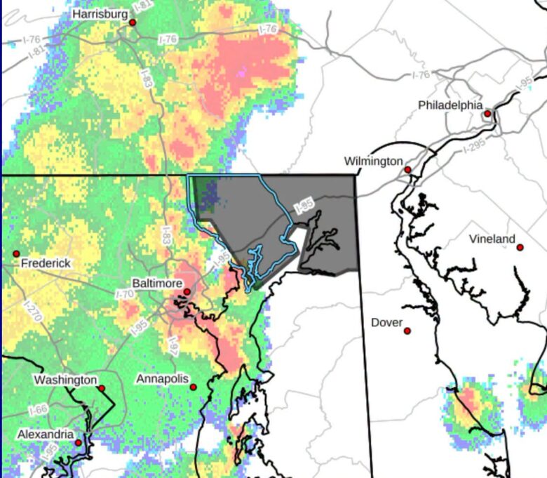
A severe thunderstorm warning is in effect for Harford and Cecil counties until 8:45 p.m. tonight.
What’s Happening: The National Weather Service in Sterling, Virginia issued the warning at 7:47 p.m. The storms were moving east at 25 mph along a line from near Stewartstown to near Bowleys Quarters.
What’s Important: Radar shows the storms are capable of wind gusts up to 60 mph. Lightning and torrential rainfall are also occurring.
How This Affects Real People: Winds may knock down trees and branches, block roads, and cause localized power outages. Unsecured light objects could become projectiles.
The Path Forward: The National Weather Service says residents should move to an interior room on the lowest floor of a building and avoid driving through flooded roadways.
Locations in the warning area include: Elkton, Aberdeen, Havre de Grace, Aberdeen Proving Ground, Bel Air South, Bel Air North, Fallston, Riverside, North East, Jarrettsville, Rising Sun, Perryman, Charlestown, Cecilton, and Bay View.

Discover more from The Harford County Sun
Subscribe to get the latest posts sent to your email.