

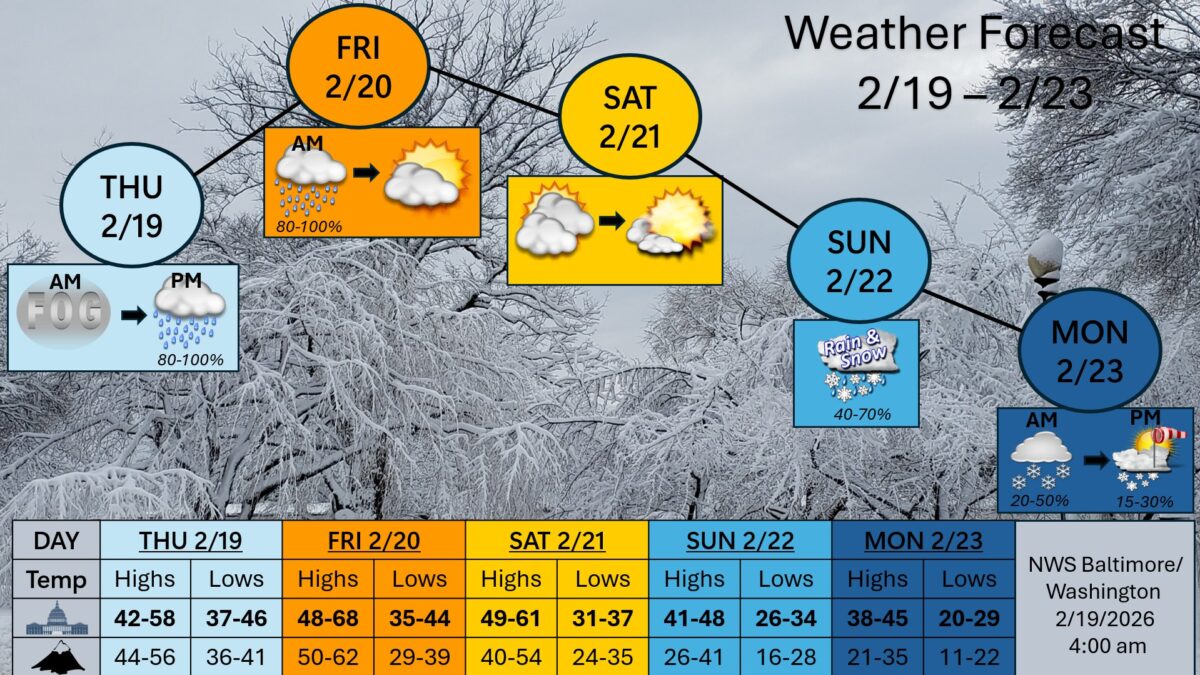
Rain, cooler temperatures, and morning fog are expected around the Baltimore-Washington region through Friday as a stalled front lingers nearby. The National Weather Service says it should dry out Friday afternoon, with warmer weather expected Saturday.
What’s Happening: Wet and foggy conditions are expected at times through Friday, then a warmer Saturday. A coastal low could bring a mix of rain and snow Sunday into Sunday night.
What’s Important: Colder temperatures are likely to return early next week.
What We Know:
- Thursday, Feb. 19: Morning fog, then rain later in the day, with an 80% to 100% chance of precipitation. Highs 42 to 58, lows 37 to 46.
- Friday, Feb. 20: Rain likely in the morning, then drying out in the afternoon, with an 80% to 100% chance of precipitation. Highs 48 to 68, lows 35 to 44.
- Saturday, Feb. 21: Warmer conditions. Highs 49 to 61, lows 31 to 37.
- Sunday, Feb. 22: A mix of rain and snow possible, with a 40% to 70% chance. Highs 41 to 48, lows 26 to 34.
- Monday, Feb. 23: Snow possible in the morning, then breezy conditions later, with a 20% to 50% chance in the morning and 15% to 30% later. Highs 38 to 45, lows 20 to 29.
The Process: A frontal boundary is the line between different air masses. When it stalls, it can keep rain and clouds in place longer because it is not moving out.